

Construction Progress Tracking with Drones: How RAZA Documents Each Project Stage
See how aerial images can document a construction project's progress, show the context of the site, and support project communication.
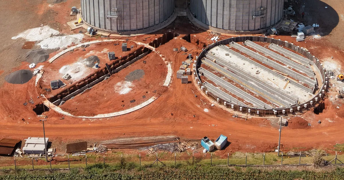
At RAZA, aerial records of a construction project are planned around what the business needs to monitor or communicate. The project’s goals, stages, and capture schedule help define how the work will be carried out.
The plan starts with the project’s goals
Before filming, we align on what the business wants to document: the overall progress of the site, specific stages, or images to present the project to clients, partners, and investors.
When the project calls for periodic records, the schedule is agreed around the pace of construction. When conditions allow, planning images from similar viewpoints can make it easier to compare different stages.
What can aerial images show?
A drone’s perspective can help show how the site is organized, its relationship to the surrounding area, access points, and visible changes as work progresses. It can also record important project stages and milestones.
These images provide visual context for reference and communication. They do not replace a technical site visit, a specialized inspection, or an assessment by the professionals responsible for the project.
Capture and delivery are agreed for each project
The scope defines whether the work includes photos, video, or both, and which materials will be delivered. Original photos may preserve location and capture-time metadata when that information is present and retained in the files.
Edited or organized material can also make the full set easier to review, depending on what is agreed with the business. The records can support project documentation and communication, but do not by themselves constitute automatic legal proof.
Related posts
From Ground to Air: How RAZA Documents Business Projects
Learn how audiovisual production, aerial imagery, and georeferenced data can help businesses document and communicate their projects.
Corporate Video for Businesses: How RAZA Plans an Audiovisual Production
Learn what to align before producing a company video, from its purpose and formats to the filming plan.